Google Maps isis one of the best location-based service apps for millions of people on computers and mobile devices. It is a highly successful and practical application that provides navigation facilities. If you need to search for any vital landmark, bookstore, petrol station, and ATM booth, ask Google, which will offer you the nearest solution. If you are a newcomer to any country or city, Google Maps will be your closest friend. Because of all those fantastic features, people are now more interested in Google Maps. Capitalizing on this interest, people develop many Google Maps alternatives to provide the same navigation facilities.
Google Maps Alternative
Though I am fond of using Google products, people search for something new because of the diversity of knowledge and thirst for learning. Finding Google Maps alternative is such a type of luxury. Moreover, people always like to find an alternative and new one. As a result, the question of the Google Maps alternative arises. On the other hand, few people want to use extraordinary things more than traditional ones. My today’s article is dedicated to them. In today’s learning, we will learn the best 20 Google Maps alternatives to give you a different flavor of navigation. All of those you can use instead of Google Maps.
1. Bing Maps
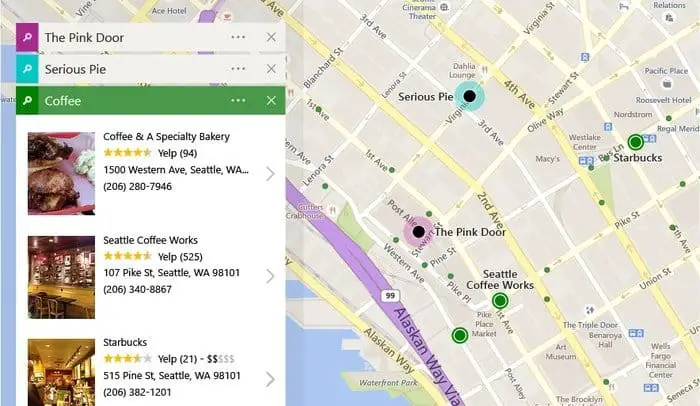 Bing Maps is the product of Microsoft, which provides the same search engine facilities as Google. Because of some powerful and handy features, Bing Maps is considered one of Google Maps’ best alternatives. This web mapping service provides real-time transit direction, cycling, and driving. The direction-finding from one location to another location is so easy. Like Google Maps, it notifies your traffic update with a different color combination. Bing Maps support any web browser and mobile platforms like Android and iOS.
Features
- Bing Maps is one of the best web mapping services.
- It has long-time success history of about 14 years ( as of 2019).
- You can see 3D maps, venue maps, Streetside views, birds-eye views, aerial views, and road views on Bing Maps.
- You also can share and embed this map on any other website.
- Bing Maps frequently update their data for the users.
2. MapQuest
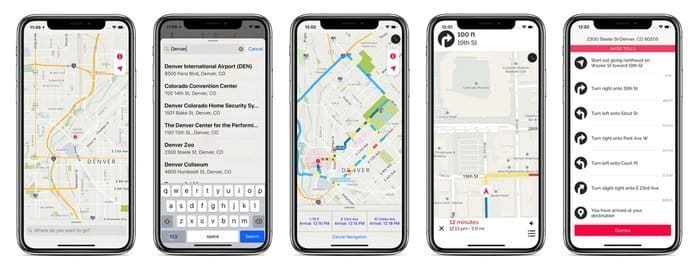 The American free web mapping service MapQuest started its journey in 1996. It was the first web mapping service for commercial use. Now it has strong competitors like Here and Google Maps. On this map, you can search for hotels, food, shopping, coffee, and Gasoline. This multilingual service is supported all over the world.
Features
- MapQuest provides street-level details on driving in a variety of countries.
- It provides accurate GasPeices result for the inhabitants of the United States.
- Using MapQuest, you can create your custom map, print a map, and even embed your custom map.
- It collaborates with a third party for hotel booking, flights, and rental cars.
- The signup for this web mapping service is optional.
3. OpenStreetMap
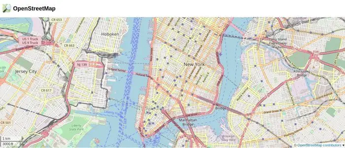
OpenStreetMap is a free application created by users like you, and it is under open licenses. This editable mapping system is a big collaborative project. The US developer Steve Coast develop this platform in the year 2004. Now it is one of the best Google Maps alternatives based on extraordinary features.
Features
- OpenStreetMap shows data on the native language of the respective countries.
- This collaborative mapping project supports 93 languages.
- Its users provide the map data of OpenStreetMap.
- Using any web browser, you can edit the data of OpenStreetMap.
- The mapper generally conducts the ground survey using OpenStreetMap.
4. GIS Cloud
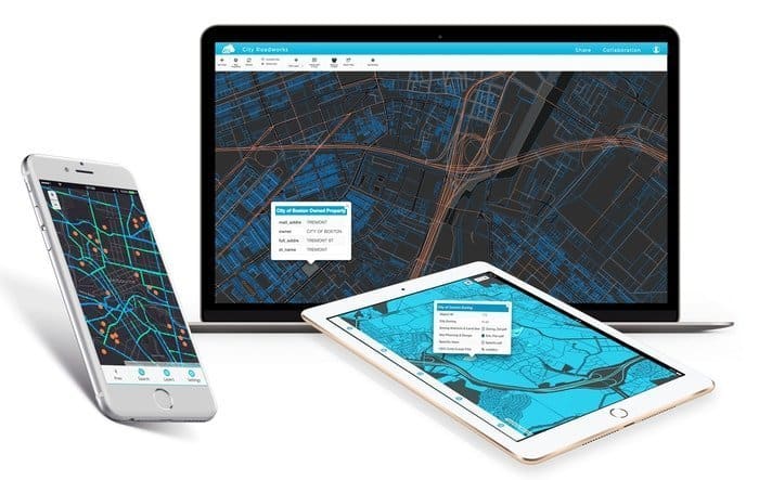 GIS Cloud is one of the best cloud-based GIS platforms which provides web mapping services. This GIS service is designed based on spatial analysis and supports real-time mapping. It has three features which are online, offline, and on-premise service. This complete mapping solution can collect data from the field, support data and team management, and edit maps and share.
Features
- With a mobile data connection, collecting points, lines, and polygons is easy.
- You can turn your map into a cloud-based GIS App using the GIS cloud.
- With the GIS portal, you can raise awareness about heritage.
- With an interactive map portal, you can support a swim marathon.
5. Here WeGo
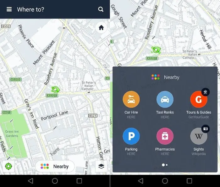 The popular web mapping service Here WeGo was developed by Nokia in 2013 for its Windows mobile. In 2014, it was incorporated for Android and later for iOS. The service of HERE includes traffic data, location service, and satellite views. After two or three months, the map is updated by itself.
Features
- Turn-by-turn navigation includes destination, landmark, business name, and approximate time to reach.
- HERE provides the data on public transport with full navigation for some countries like Switzerland, Denmark, Singapore, and Germany.
- It shows real-time information with traffic information of 63 plus countries.
- Since it provides storage facilities to a device, it does not require internet data for navigation.
- This English language-supported application supports Android, iOS, Windows phones, and any web browser.
6. Géoportail
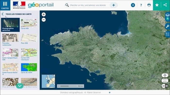 Géoportail is one of the best Google Maps alternatives in France. It is the web mapping service of the France Government for providing aerial photographs from more than 90 sources. The former president of France, Jacques Chirac, inaugurated the service in 2006. Though the French people think of it as an alternative to Google Maps, it has many differences from Google Maps.
Features
- Géoportail is a French language-based web mapping service.
- This application was developed for the Ministry of Ecology, France.
- It is helpful for aerial photographs, complimentary maps, and old maps.
- It supports Windows, Android, and iOS platforms.
7. Foursquare
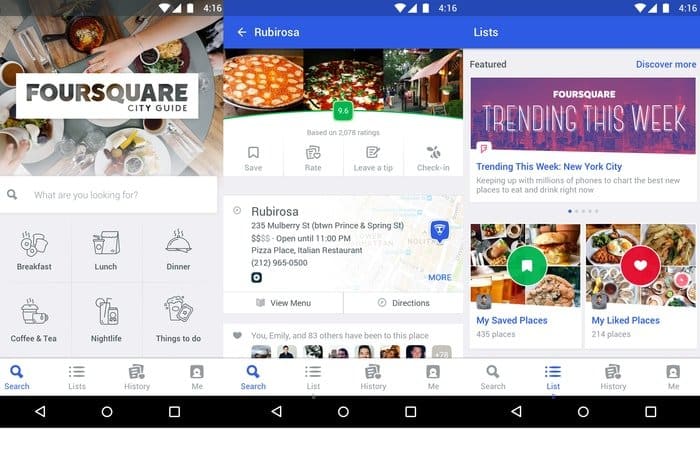 Foursquare is a local search and discovery mobile app used as a city guide. Based on previous browsing and check-in history, it provides you with a recommendation. This location-tracking platform improves the movement of people in the real world. The check-in technology of Foursquare started in 2009. Uber, Tencent, Apple, Samsung, and Twitter use Foursquare technology.
Features
- Foursquare provides a local search and recommendation system to customize your map.
- It supports many languages like English, German, Russian, Thai, and Turkish.
- Registration for Foursquare is not mandatory.
- It focuses on user-written tips and recommendations.
- In addition to various tips, it allows users to rate multiple venues.
8. Yandex.Maps
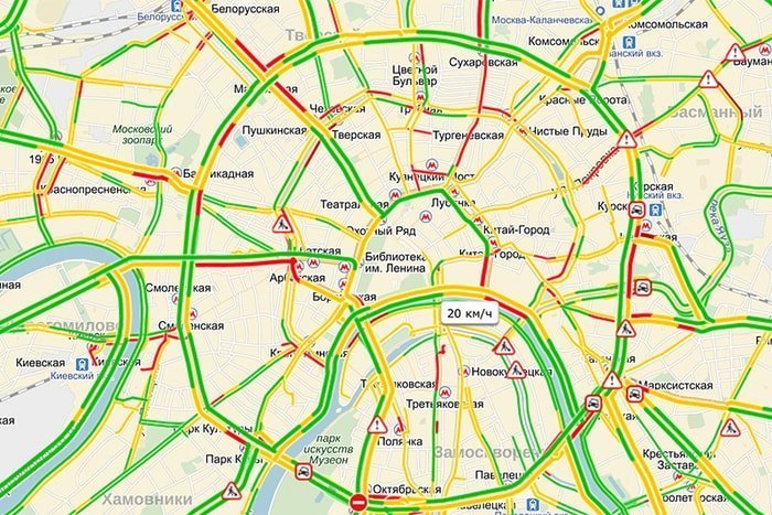 Yandex. Maps are one of the best Google Maps alternatives in Russia. But throughout the world, this web mapping service is used by all. This service was introduced in 2004. Since then, it has provided routing, street panoramas, traffic jam information, and search facilities. This multilingual web mapping platform is written in C++, JavaScript, XML, and AJAX. Yandex. Maps support Windows, Android, and iOS platforms.
Features
- Besides Russia and Ukraine, the Yandex. Maps are now available all over the world.
- Using Yandex maps, you can see the street view and street panoramas.
- Yandex. Maps editor allows us to make new data and edit the map.
- The traffic system of Yandex. Maps describe the live situation accurately.
- However, despite many features, it is less productive than Google.
9. Mapbox
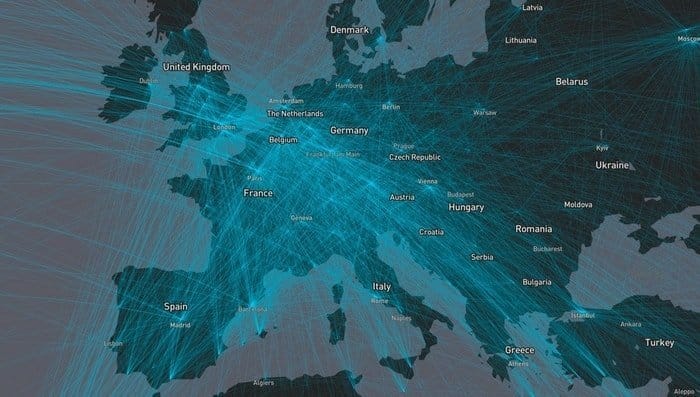 Mapbox is an American live location platform for providing web and mobile solutions. It gives location search, custom maps, turn-by-turn directions, and embed facilities to your application. With this ultra-fast and traffic-aware ETA, you can analyze your user and change your industry with real-time routing and asset tracking since it is faster and more flexible, so you can visualize your geospatial data, which is available on the web, desktop, and mobile.
Features
- Mapbox empowered developers to the decentralized sensor and feed back live location data.
- CNN, GitHub, National Geography, and Mastercard use this mapping solution.
- You can augment the map reality with the physical world, including live location data, global object persistence, points of interest, and games.
- The data of Mapbox is taken from an open source like NASA and OpenStreetMap etc.
- With the dashboard, you can customize this map with administrative, postal, and statistical boundaries.
10. CARTO
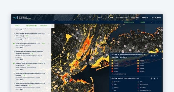 CARTO is a world-famous location service provider with artificial intelligence. It converts location outcome data to business outcomes. On the other hand, it is very efficient in strategically placing stores, targeting marketing campaigns, and delivering routes. With CARTO, you can solve spatial problems with the best data analysis. It follows five steps: data ingestion, enrichment, analysis, solution and visualization, and integration—this Google Map alternative benefits data scientists in data preparation and enhancement.
Features
- CARTO is an ultimate development framework with a visualization library, geocoding, routing, isoline, and data API.
- With the prototype response features, you can upload your data and develop quickly.
- It visualizes millions of points smoothly.
- This open-source software is written in JavaScript and Ruby.
- CARTO offers services for web applications, mobile application API, JAVAScript, and Python packages.
11. ArcGIS Online
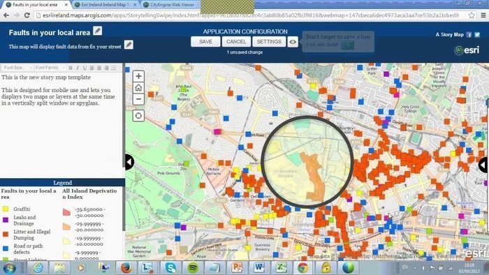 ArcGIS Online is one of the most popular visualization platforms for solving the mapping solution. It provides cloud-based easy tools for coordination. Using this ArcGIS Online, you can create a web map after signup. You can view this map on the desktop browser or any mobile device. It is also possible to share it on any blog or via mail.
Features
- ArcGIS Online is suitable for developers.
- You can incorporate maps and data on both mobile and desktop platforms.
- ArcGIS Online has a vibrant gallery of unusual species.
- It offers separate pricing options for creators, viewers, field workers, editors, and GIS professionals.
- It offers many particular programs like a conversation, disaster response, and nonprofit organizations.
12. Waze
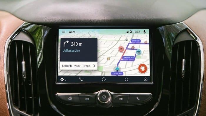 Waze is one of the best Google Maps alternatives on Android applications. It provides GPS, traffic alerts, and live navigation. Waze informs you what is happening on the road regarding traffic, police, hazard, and more. To avoid traffic, you can change the route instantly using wage. It helps to find the cheapest gas on your path. This mapping app is one of the editor’s choices for Google Play.
Features
- Millions of people used Waze technology and made a Waze community to improve roads together.
- You can use the live map from Waze.
- While you drive, you can take the help of the voice guide of Waze.
- You also can drive the Android auto with Waze.
- You can find the estimated time of arrival using live traffic.
13. Maps. me
 Maps. Me is a mapping service compatible with Android, iOS, and BlueBerry using OpenStreetMaps. This application is written in C++, Objective-C, and Java. For personal and commercial use, Maps. Me provides free API to developers. It is registered under Apache License.
Features
- The data of Maps. Me is updated once or twice each month.
- Maps. I support GPS maps.
- You can search offline by name, address, category, and coordinates.
- I work as a Map editor, bookmarks, and auto-follow mode.
- Location and bookmark sharing with KML import.
14. CoPilot GPS – Navigation
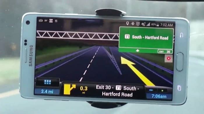 CoPilot GPS – Navigation is one of the best web mapping applications used in the car. The CoPilot GPS can be one of the best Google Maps alternatives for its standalone GPS features. CoPilot helps to maintain efficiency, safety, and compliance. You can deploy commercial-grade navigation with an OEM solution. Finally, routing, scheduling, visualization, and navigation are more accessible because of CoPilot GPS – Navigation.
Features
- CoPilot GPS – Navigation shows where a potential delay may occur on your route.
- The intelligence estimated time of arrival tells you when you will arrive.
- It saves time and fuel.
- Over 150 countries of the world use these navigation tools.
- It supports Android, iOS, and Web browsers.
15. Citymapper – Transit Navigation
 Citymapper is one of the best Google map alternatives for Android applications. This transit navigation tool checks nearby departures in real-time and find the fastest route for subway, bus, train, car, bike, etc. According to Newyork Times, the Citymapper is one of the best travel apps, and at the MTA New York app quest, it won the first prize.
Features
- Citymapper finds the best route to it and can be used as a trip planner.
- IT Shows real-time bus and train departures in the USA.
- It provides you with an alert when your favorite lines are disrupted.
16. BackCountry Navigator TOPO GPS
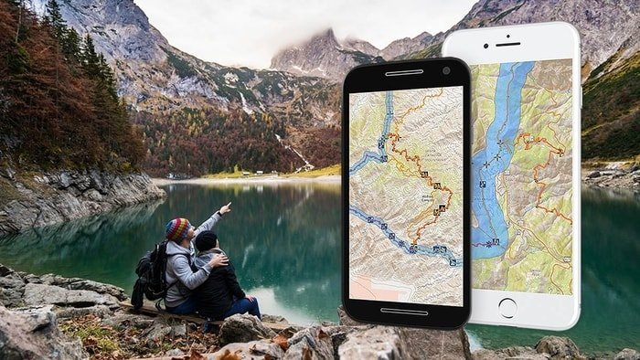 BackCountry Navigator TOPO GPS is one of Android applications’ best Google map alternatives. It is workable on an offline outdoor navigator. So you can explore beyond cell coverage for recreation like hiking. Your Android app supports this navigation tool to see at a glance. Since this is a paid app, you must buy it before using the pro version of BackCountry Navigator TOPO GPS.
Features
- BackCountry Navigator provides colorful marine and aerial photography.
- It is flexible and featured with fun so that you can preserve your memory with the map.
- This app is highly effective for the hiker of the mountain.
- It supports the features of a geocaching navigator using a pocket query as a GPX.
- It is widely used in developed countries like New Zealand, Japan, and the USA.
17. Polaris GPS Navigation
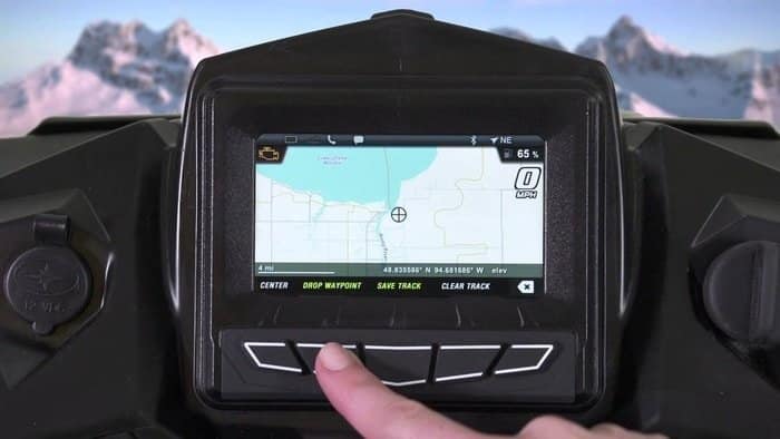 Polaris GPS Navigation suits you if you are fond of hiking, marine tours, and adventure off-the-road. Polaris GPS Navigation turns your phone into robust GPS. So you can use these mapping tools as your Google map alternative for Android. It allows you to record your trail during hiking at any off-the-road.
Features
- All marine navigation charts, like sailing and boating, are free with Polaris GPS Navigation.
- If you are fond of fishing, you can use this fishing GPS.
- Camping, geocaching, and hiking & hunting are possible with this app.
- It is suitable for mountain biking and bike apps.
- Since it is a free app so you may find some advertisements on this app.
18. GPS Navigation & Maps Sygic
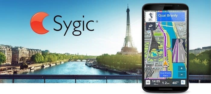 Sygic GPS Navigation is one of the best Google map alternatives for offline navigation. More than two million users use this web mapping tool. TomTom powers this turn-by-turn navigation software. With some Ads-on features, you can take the user to the next level of adventure. Because of its head-up display, you can drive at night.
Features
- GPS Navigation & Maps Sygic coordinates with Dashcam, which can continuously record the last five minutes.
- It allows you to replace your map with a real-world view.
- Its robust feature Cockpit allows you to show the real-time performance of your car.
- Some other mobile apps are Sygic car navigation, Sygic travel, Sygic cameras, and family locator.
19. OsmAnd
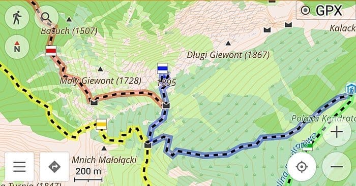 OsmAnd is one of the best Google map alternatives for online and offline map viewing and navigation. It has fast online options. On the other hand, you can use it offline without roaming internet charges. It automatically reroutes if you deviate from the original route. OsmAnd can search please by address, type, and geographical coordinates.
Features
- OsmAnd can display your orientation and position on the map.
- It displays your point of interest around you.
- You can save your most preferred place according to your wish.
- The offline map helps your foot, hiking, and biking paths.
- This up-to-date map provides high-quality information.
20. Navmii
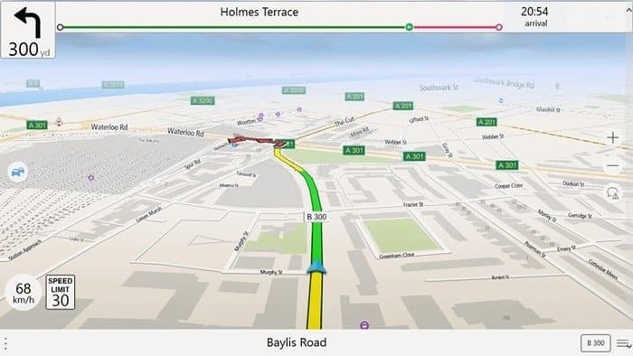 Navmii is a mapping and navigation service provider. It helps to create an automated grade digital map from the service of OpenStreetMap. You are allowed to use the SDK of Navmii for using your app. So you can easily add navigation and search features to your website and mobile application. It also supports premium turn-by-turn voice-guided navigation.
Features
- The users of Navmii will get a sophisticated navigation experience.
- The Dashcam app, with built-in Artificial intelligence, continuously analysis the road.
- For professional drivers, it navigates turn by turn with premium quality and routing.
- It provides voice-guided navigation and lives traffic intelligence.
- Some other features include HD mapping, truck navigation, automotive navigation, and EV navigation and routing.
Final Words
After a long list of Google Maps alternatives, you may be puzzled. So our experts discover some of the best alternatives of Google Maps as web mapping tools. According to the features, Bing Maps, MapQuest, OpenStreetMap, and HERE are the best options for Google. At the same time, you may find some other best maps that can be used instead of Google Maps. However, we are eagerly waiting for those, and inform us of the recommended manes through comments. We will incorporate those as soon as possible.


